

ABOUT AEROVELD

Aerial intelligence.
Grounded insights.

Connecting data capture, analytics

and real-world decisions.

OUR STORY

A clearer view.
A stronger foundation.

Aeroveld is a South African technology company bringing together aerial data capture, engineering expertise, data management, analytics and visualisation.

Founded by Steffan and Wern van Molendorff, Aeroveld is built on the belief that better decisions begin with better information. We are developing an integrated approach that connects observations from the physical world with relevant data and practical analysis — helping organisations gain a clearer understanding of their sites, assets and operations.

South African roots

Proudly founded in South Africa, Aeroveld combines local insight with a global outlook, developing technology-led solutions for real-world challenges across industries.

Data-led thinking

Connecting aerial data capture, engineering expertise and analytics to turn complex information into clearer, more meaningful insights.

Practical outcomes

Focusing on the questions that matter to your business, with analysis and visual intelligence designed to support informed decisions and practical action.

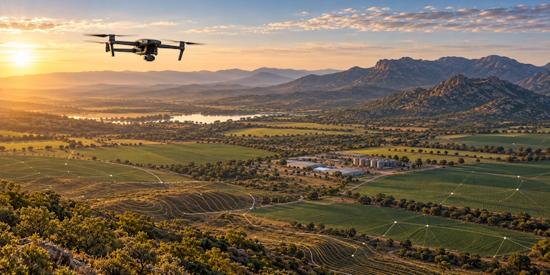
Aeroveld Data Capture - Drone Mapping Over South African Valley

OUR VISION

To be the world’s benchmark for aerial intelligence and advanced analytics — transforming complex data into grounded insight that empowers smarter decisions, redefines what’s possible, and delivers measurable real-world impact.

OUR MISSION

To combine drone technology, artificial intelligence, advanced analytics and deep industry understanding to deliver trusted intelligence, actionable insights and measurable business value to our clients.

We move beyond traditional drone services by connecting aerial data capture with engineering expertise, enterprise data and analytics — helping organisations turn information into meaningful insights that support better-informed business decisions.

OUR APPROACH

From captured data to clearer decisions.

01

Capture

Collect aerial imagery, visual observations and relevant spatial information tailored to the project's objectives and operational requirements.

02

Aeroveld - Connected database cylinder icon

Connect

Organise captured information and integrate relevant data from existing business systems and other sources, where appropriate.

03

Analyse

Explore patterns, trends and exceptions through structured analysis, helping identify relevant findings and areas that may warrant further investigation.

04

Understand

Translate findings into clear visualisations, reporting and actionable insights designed to support informed business decisions.
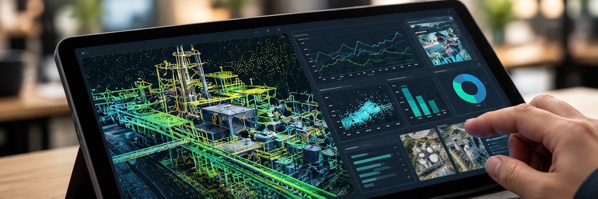

Aeroveld - Tablet displaying industrial analytics

Built around the
question that matters.

We start with your business challenge, then shape the data capture, integration and analytical approach around the information needed to support informed decisions.

Purposeful capture

Capture relevant aerial imagery and observations aligned with your objectives and the questions you need to answer.

Connected information

Bring relevant data sources together to build a more complete view of your assets, sites and operations.

Purposeful capture

Explore patterns, trends and exceptions to develop insights that help clarify operational conditions and inform next steps.
THE PEOPLE BEHIND AEROVELD

Experience that connects
technology and opportunity.

Have a business challenge that better data, aerial intelligence or analytics could help address? Connect with our founders to explore how Aeroveld’s combined data, engineering and industry expertise could help turn information into practical insights and support better-informed decisions.

Wern van Molendorff

Co-founder & Director

OUR FOCUS FOR THE FUTURE

Building with purpose

Our focus is on strengthening operational readiness, demonstrating practical applications and developing solutions shaped around real industry needs. Through targeted use cases and collaboration with prospective clients, we aim to explore how aerial intelligence, engineering expertise and data analytics can address practical business challenges.

Mining & Industry

Exploring applications for site documentation, infrastructure observation and asset monitoring to support industrial visibility and informed operational planning.
Energy & infrastructure

Developing practical applications for infrastructure observation, asset documentation and monitoring to support inspection and maintenance planning.

Agriculture & land

Exploring aerial data capture and land-monitoring applications to help observe changing conditions, document land and support more informed management decisions.


Lets explore what your data could reveal &
help you decide?

ell us about your site, your assets and the decisions you need to make. Together, we can explore how aerial data, engineering expertise and analytics could help you gain clearer insights and make more informed decisions.